
دوتنه:Yangtze river banner.jpg
د همدې ليدنې کچه: ۷۹۸ × ۱۱۴ پېکسل. نورې ژورليدنې: ۳۲۰ × ۴۶ پېکسل | ۲٬۱۰۰ × ۳۰۰ پېکسل.
اصلي دوتنه (۲٬۱۰۰ × ۳۰۰ پېکسل, د دوتنې کچه: ۳۷۸ کيلوبايټ, MIME بڼه: image/jpeg)
لنډيز
| څرگندونه |
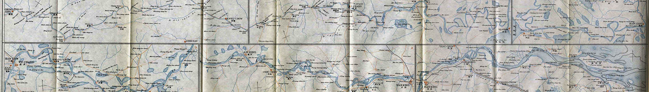
English: Wikivoyage banner: The map of the Yangtze Valey, scale 1;1,200,000. From An Official Guide to Eastern Asia, Volume IV: China. Published by The Imperial Japanese Government Railways. Tokyo, 1915. |
| نېټه | |
| سرچينه | File:Yangtze_kiang_1915.jpg |
| ليکوال | Compilers of " An Official Guide to Eastern Asia, Volume IV: China. Published by The Imperial Japanese Government Railways. Tokyo, 1915. " |
منښتليک:
This media file is in the public domain in the United States. This applies to U.S. works where the copyright has expired, often because its first publication occurred prior to January 1, 1929, and if not then due to lack of notice or renewal. See this page for further explanation.
|
 | |
 |
This image might not be in the public domain outside of the United States; this especially applies in the countries and areas that do not apply the rule of the shorter term for US works, such as Canada, Mainland China (not Hong Kong or Macao), Germany, Mexico, and Switzerland. The creator and year of publication are essential information and must be provided. See Wikipedia:Public domain and Wikipedia:Copyrights for more details.
|
د دوتنې پېښليک
په يوې نېټې/يوه وخت وټوکۍ چې د هماغه وخت او نېټې دوتنه چې څنگه ښکارېده هماغسې درښکاره شي.
| نېټه/وخت | بټنوک | ډډې | کارن | تبصره | |
|---|---|---|---|---|---|
| اوسنی | ۲۱:۵۹, ۳۱ اگسټ ۲۰۱۳ | ۲٬۱۰۰ × ۳۰۰ (۳۷۸ کيلوبايټ) | Armigo~commonswiki | User created page with UploadWizard |
د دوتنې کارېدنه
دا لاندينی مخ د همدې دوتنې سره تړنې لري:
د نړېوالې دوتنې کارېدنه
همدا دوتنه لاندينۍ نورې ويکي گانې کاروي:
- په en.wikivoyage.org کارونې
- په eo.wikipedia.org کارونې
- په fr.wikivoyage.org کارونې
- په vi.wikivoyage.org کارونې
- په www.wikidata.org کارونې
- په zh.wikivoyage.org کارونې